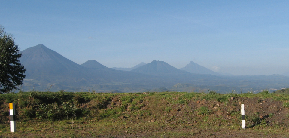
Mount. Muhabura is one of the mountains that lie in the Virunga massif. The mountain is sometimes referred to as Mount. Muhavura is located at the border between Uganda, Rwanda, and the Democratic Republic of Congo and is the highest mountain among all the eight mountains in the Virunga massif. The name Muhabura a Kinyarwanda local name that means "guide".
The mountain stands at an altitude of 4,127 meters above sea level lying in the Virunga ranges that are located in the western arm rift valley of Africa. The mountain is worth interesting whereby it provides spectacular views of the surrounding rolling hills, plains, and vegetation not forgetting the views of the crater lakes and the twin lakes of Rwanda. The mountain can be climbed from either Uganda or Rwanda which is not the case with the sister volcanoes the Sabinyo which can only be climbed from one side of Uganda.
Hiking this mountain is an interesting activity and while on the hike there are two main stopovers whereby the first stop lies at an altitude of 3116 meters above sea level and the second lies at an elevation of 3885 meters above sea level. Since there are craters, visitors who come to hike have a chance of swimming if they are interested in it, and hiking up to the summit is sometimes difficult because the peak is very cold which makes some tourists unable to reach there and stop at the first stopover.
This activity of hiking is one of the best and usually requires someone to be physically fit enough because the mountain is one of the steepest mountains in the Virunga massif and is connected to mountain Gahinga which has a crater lake of 40 meters deep at the summit. This will give you a great opportunity to have views of the three countries of Uganda, Rwanda, and the Democratic Republic of Congo.
Hiking will give you a great memory that will keep you with a great smile. This will start early in the morning and to reach the top of the mountain lasts for almost one full day most hikers who would like to hike this mountain are always advised to come with hiking gear such as hiking shoes/gumboots, gardening gloves, warm stockings, a pair of gaiters, cameras, binoculars, hiking sticks, rain jackets, long-sleeved clothes, sunscreen, insect repellants, a hat, energy giving snacks, first aid kit and a bottle of drinking water.
The mountain not only has the highest peak, and crater but also has many animal species that visitors will encounter while on their visits such as the golden monkeys, hyenas, mountain gorillas, duikers, and many more animals that you spot at certain points as you are having views of the surrounding environment and other volcanoes like the Sabyinyo, Gahinga, Bisoke, Karisimbi and the Burera and Ruhondo craters of Rwanda. Most tourists who come to hike this mountain normally combine it with other activities such as golden monkey trekking in Mgahinga National Park, and mountain gorilla trekking either in Volcanoes National Park or in Mgahinga National Parks.
Hiking this mountain requires one to have a permit and you need to purchase a permit in advance but it is also possible to buy it on the day of the hike directly at the park headquarters. Hiking this mountain can be done all year round but some months are better than others, especially in the dry season. These months are usually June to September and December to January because the trails are passable, vegetation is thin, and with little rainfall or no rainfall at all.